Back to the Fannaich range and a refresher in navigation!

Introduction - the Fannaich's
The Fannaich's (or Fannich's) are a group of mountains that lie south east of Ullapool and north of Achnasheen. They are nestled between Loch Fannich, Loch Glascarnoch and Loch a'Bhraoin. There are nine munros in the range and they can be climbed together if you are supremely fit. With the exception of Fionn Bheinn, all the munros lie to the north of Loch Fannich.
The closest village for accommodation and food is Ullapool. On this trip I stayed in the Ceilidh Place, not the bunkhouse, and enjoyed wonderful service and excellent food. There is a very relaxing residents lounge with views down Loch Broom and the a wee impromptu ceilidh started during dinner with a guitarist and a few fiddlers. All very chilled and convivial.
The focus for this trip was to climb Sgurr Breac and A'Chailleach. These two munros are the most westerly in the range and can be climbed with Meall a Chrasgaidh, Sgurr nan Clach Geala and Sgurr nan Each. That had been my intention last summer and I intended to camp on the ridge but the best made plans can become undone and I camped at the bealach leaving the westerly peaks for another trip.
Onto the main event then, below you'll find my stats, the route, and information you will hopefully enjoy and find useful.
Stats and stuff - munros; maps & timings
Munro number: 42 and 41
Munro name(s): Sgurr Breac 999m (3277ft) and A'Chailleach 997m (3270ft)
Area: Beinn Dearg & Loch Fannaich
Maps: Fannichs: Seana Bhraigh & Ben Wyvis (harveymaps.co.uk); OS Map of Beinn Dearg & Loch Fannich | Explorer 436 Map | Ordnance Survey Shop
Distance: 12.5 miles (20km)
Ascent: 1047m (3438ft)
Moving time: 5 hours 30 mins
Total time: 7 hours 40 mins
Ratings
Bogginess ☹️☹️☹️☹️☹️
Effort 😅😅😅
Navigation 🤔🤔🤔🤔
Enjoyment 😍😍😍
Local information
Eating: Home | Mysite (seafoodshack.co.uk); The Ceilidh Place - Ullapool Rooms, Restaurant, Cafe & Bookshop; Restaurant - The Seaforth
There are loads of places to eat in Ullapool but having sampled the wares from these three I know for sure I can recommend them.
Accommodation: The Ceilidh Place - Ullapool Rooms, Restaurant, Cafe & Bookshop - you need to contact the Ceilidh Place directly to book both rooms and the bunkhouse.
Home | millviewbnbullapool - contact direct to book, brilliant B&B.
There is a lot of accommodation in Ullapool. Most is represented on Booking.com. I have stayed at the above facilities, neither of which are on Booking.com but I would definitely stay again.
Facilities: Tesco; Petrol; climbing shop; various galleries; museum and many more! Visit this site for lots of information Welcome to Ullapool - Accommodation Highlands of Scotland
Don't miss: Corrieshalloch Gorge | National Trust for Scotland (nts.org.uk)
The route
As with most of the Fannaich's, the drive from Ullapool is quick and easy and it's possible to start climbing within 30 minutes of leaving the village. A leisurely and luscious breakfast set me up for the day.
Leave Ullapool returning along the A835 towards Inverness and turn right at the Braemore Junction heading west and south to Gairloch past the Corrieshalloch Gorge. The starting point is on the A832 about 6km west of the junction. There is limited parking on the verges and a small parking spot about 100m west of the starting track. The path is signposted for the long distance walks past Loch a Bhraoin to Kinlochewe and Lochluichart.
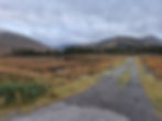
The day had promised some high cloud but when starting I quickly realised this would be a navigational refresher as the cloud base was sat around 800m. Sometimes on days like these you walk through the cloud and experience a magnificent temperature inversion with blue skies and a sea of cloud below you, but not today!
Follow the track down to the edge of Loch a Bhraoin and take a small footbridge left across a small stream and into the forest. It feels counterintuitive, however, on emerging from the forest you are directed straight to a larger bridge across a much larger river, a tributary from Loch a Bhraoin to the Abhainn Cuileig. Once across this bridge there are two routes up the glen, and having now done both of them, they are equally boggy. Today I took the track to the left which has the advantage of leading you directly to the drier path higher up the glen, but crosses a dodgy bridge and follows an track churned up by an argocat vehicle. Either way you're going to get soggy and gaiters help to keep you dry.


The walk to the bealach over to Loch Fannaich is about 6km and took me around 2 hours. Once there I knew I should take a bearing for the first summit so took my time to get my compass and map out and get set up. See my top tips below for basic navigational skills to get you through the mountains. Even though the mountain has a very clear path, once on the top in mist it can be very disorientating.


The cloud lifted at the top of Sgurr Breac long enough to see the onward route over Toman Coinich to A'Chailleach, and then it closed in. A new bearing set and I was off again not hanging around on the cold wet top.


Just to show you that it's not always blue skies and sunshine, but hey I still look happy!
The descent from the top of A'Chailleach involved retracing my steps for around 200m and then descending where the summit ridge met the descending ridge of Sron na Coibhre directly north. The only problem with this was I couldn't see Sron na Coibhre and had no idea where the ridges met. This is where my training kicked in. I knew how many steps I take to cover 100m and and had taken a bearing for the ridge of descent so after 200m I turned left and started to descend. It worked. The ridge appeared ahead of me as I dropped out of the clouds.

A huge sigh of relief! You can trust your skills and must trust the compass, but there will always be that wee niggle. is it right? Bad cops saying are you sure and good cops getting a little nervous but it's all good.
The views to the north and west now opened up and they were amazing. The autumn colours can be just as beautiful under a grey sky.


After following Sron na Coibhre almost to the end, a steep grassy slop strewn with large boulders affords a descent towards Loch Toll an Lochain. There are no paths here and numerous deer tracks. The general descent after crossing the outflow from the lochan is north passing an impressive waterfall. By now you can see Loch a Bhraoin and if you head for the loch following the contour of the hill you will join a stalking path leading back to the bridge over the Abhainn Cuileig.
The day had been long and wet underfoot, and a little challenging with regards to navigation, but at least the complete lack of wind was not accompanied by midges, and the reflections in Loch a Bhraoin were stunning. The mirror of the loch and the land above barely discernible in some photos.


Chatting to my husband as I made my way back over the bridge to the car he wondered how I was coping returning in the dark. Being 200 miles further south dusk had already settled with him but I still had around 30 minutes left I guessed.
Looking back on the day comparing the starting photo with the finishing photo it's clear to see how the weather can change. Great views from the summit now! A'Chailleach was clear and boasting.


A'Chailleach is Gaelic for "old woman" and I felt a bit like that in the disappearing daylight, but also incredibly proud to be safe and sound, and reassured in the knowledge that my navigational skills are sound.
Claire's top tip....
Essential navigational skills....
As mentioned, today was a day I was very happy to know how to use a map and compass. Yes, a GPS would be easier, and I would have been sure that I was descending the ridge and not heading towards the cliffs, but what if the GPS had failed? Basic navigational skills are sound and your compass is not going to run out of power or need a factory reset.
So here a are a few on the job photos to accompany a wee navigational tutorial...

Align your map to north. The map has blue lines that run up and down, and across the map. The ones running up and down are called "northings", and the ones running across are "eastings". The squares they create represent a kilometre square. Lay the map flat on the ground and lay your compass on the map. Make sure the red needle that moves around inside your compass is lined up with the red hatched arrow on your compasses body. This moveable arrow points north. Move your map so the northings are aligned with the vertical lines on your compass. Your map is now pointing north.

Get a bearing (that is a direction to follow between two points). Line up point A (where you are) and point B (where you want to go) with the side of your compass. Make sure that the direction of travel arrow is pointing in the direction you want to go in (so towards point B). In the above picture, I want to go from point 548m on the map to the top of Sgurr Breac at 999m. Ensure the compass arrow is within the red hatched area and pointing north.
Magnetic Declination - Don't let this bit confuse you as with such a small variation in the UK you can often ignore it, but it can become critical in some parts of the world or in featureless areas. The variation is normally annotated on your map, but it's best to check online as this can change and maps can be years old.
When you lift your compass off the map you would normally need to adjust for something called magnetic variation. However, at the moment, the difference between Grid North (the northing lines on your map) and Magnetic North (where the actual compass arrow thinks north is, given magnetic disturbance in the earth) is almost the same. For Ullapool it is currently only 0.5 degree of a difference. If the variation was much greater, say 4 degrees, you would need to adjust your compass to correct it.
Line yourself up. You don't need the map now. Pick up the compass and do not change anything. Hold the compass directly in front of you, keep the red arrow in the red hatching, and follow the large black arrow showing the direction of travel. Always keep the red arrow north. Look up, and pick an object in the distance that’s in exactly the right direction. It could be a distinctive tree, rock, hill peak or similar.
In the pictures below you can see the red arrow is always in the red hatching, and the black direction of travel arrow is point up the hill towards the top. Handily the path is very clear and you can see the compass pointing straight at it.


The two biggest errors by beginners are: Moving the bezel – it’s set and should not be changed at this point. Secondly, not holding the compass pointing directly away from the body. Also, be aware of any magnets or metal near the compass: mobile phones, magnetic buttons, metal belts and similar can ‘deflect’ the compass needle, making it inaccurate.
If you are going to be heading to the hills on a regular basis I suggest taking a course on map reading. Mountaineering Scotland run one day navigation courses in a number of areas in Scotland. Please see the link below.
Navigation courses | Mountaineering Scotland
Coming next......
TBC!!
Winter is here and I will do some climbing but this will totally depend on good weather and acceptable conditions underfoot. I don't take risks at any time but especially in the winter in the Scottish Highlands.
Thank you for reading ❤️ xx
Related Posts


